The oases of south-eastern Morocco: a civilisation shaped by water
Between the High Atlas, the Saghro and the Saharan fringes, south-eastern Morocco is crossed by long ribbons of greenery that are anything but accidental. An oasis is not simply a palm grove that has sprung up around a source of water: it is a constructed landscape, the result of centuries of water management, agriculture, collective rules and earthen architecture. From the Drâa to the Tafilalet, from Skoura to Tinghir, these systems have shaped places, societies and much of the region’s identity. Their history, now better understood through archaeology, also tells the story of the routes that once linked the Maghreb to the Sahara and sub-Saharan Africa.
Overview
- The oasis, a landscape shaped by people.
- An ancient history of oases, routes and caravans.
- Water, the foundation of every oasis.
- The ksar and the oasis, two inseparable realities.
- Agriculture organised in several layers.
- The great oasis landscapes of south-eastern.
- Morocco Oases under growing pressure.
- A living heritage to preserve.
The oasis, a landscape shaped by people
At first sight, an oasis may seem like an enclave of vegetation that has appeared naturally in the middle of an arid landscape.
Yet it is almost always the result of long and patient human labour.
To make dry land cultivable, water must first be found, captured and brought to the fields. Its distribution must be organised and the structures that carry it maintained. The soil must then be protected, crops planted and irrigated, and farming adapted to local conditions.
An oasis is therefore less a miracle of the desert than an agricultural, hydraulic and social construction.
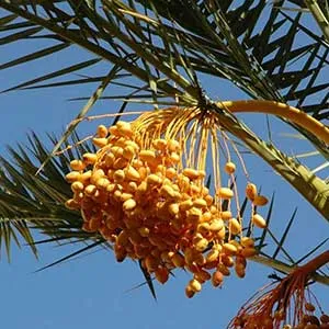
The date palm is its most visible symbol, but it does not define the oasis on its own. An oasis generally combines several layers of crops, irrigation channels, paths, areas of settlement, granaries, ksour and sometimes grazing land.
In south-eastern Morocco, these landscapes mainly follow the valleys descending from the Atlas or cutting through the pre-Saharan reliefs: the Drâa, Dadès, Todgha, Ghéris and Ziz.
They form lifelines through territories where a few kilometres may be enough to pass from intensively cultivated land to an almost entirely mineral landscape.
An ancient history of oases, routes and caravans
The history of the oases of southern Morocco was long presented as that of nomadic populations gradually becoming sedentary with the development of trans-Saharan trade and the arrival of Islam.
Recent archaeology reveals a history that is both older and more complex.
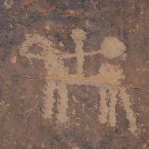
Research carried out since 2015 in the Middle Drâa Valley by Moroccan and British teams has identified hundreds of sites: hilltop settlements, necropolises, oasis villages, fields and irrigation networks. Dating suggests that oasis agriculture and forms of permanent settlement were already present between the fourth and eighth centuries, before the Muslim conquest of Morocco.
More recent work by the OasCiv programme has confirmed the importance of these early occupations and identified agricultural activity at settlements predating the great medieval expansion.
From the eighth and ninth centuries onwards, however, a change of scale took place.
Irrigated areas expanded, new earthen settlements appeared and the oases became increasingly closely connected to the great Saharan trade networks. Between the eleventh and thirteenth centuries, under the Almoravids and then the Almohads, the Drâa Valley experienced a period of strong agricultural and demographic growth. Archaeologists now speak of a genuine expansion of medieval oasis landscapes.
This history cannot be separated from that of the routes.
The valleys of the South-East formed natural corridors between the passes of the Atlas and the Sahara. Caravans found water, food, people, animals and markets there.
The oasis was therefore not simply a place to stop between two stages of a journey: it produced the resources that made travel possible.
Sijilmâsa, a city born of the oasis and trade
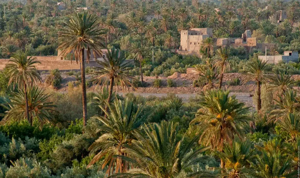
The most spectacular example is Sijilmâsa, founded in the eighth century in the Tafilalet, near present-day Rissani.
For several centuries, the city was one of the great caravan ports of the Sahara. It linked the Maghreb with the Sahel and played a major role in the circulation of gold from West Africa. For almost half a century, Sijilmâsa even became the principal mint for gold dinars in the Maghreb.
Yet the city’s power also depended on its oasis.
Its population, markets and passing caravans all had to be fed. The Ziz and Ghéris supplied vast cultivated areas through dams, diversions and networks of canals.
When Sijilmâsa declined from the end of the Middle Ages onwards, the oasis did not disappear. The organisation of the territory changed: populations became more widely distributed among fortified ksour, while new hydraulic networks developed.
The history of the Tafilalet therefore shows that an oasis can change its form without ceasing to exist.
Read more: Sijilmassa, the legendary city at the true heart of the Maghreb.
Water, the foundation of every oasis
The history of an oasis is first and foremost the history of its water.
In south-eastern Morocco, this water may come from wadis fed by rain and snow in the Atlas, from springs or from underground aquifers. Oasis societies developed different techniques to bring it to cultivated land.
Séguias are channels, traditionally dug into the earth or lined with masonry, that divert water towards gardens and fields. On the larger wadis, dams or diversion structures could also direct part of the floodwaters towards agricultural land.
Wells have likewise played an essential role, sometimes using lifting systems once powered by animals.
Some regions also developed khettaras: long underground galleries that intercept groundwater and carry it by gravity to lower-lying fields.
The Tafilalet preserves one of the most important concentrations in Morocco. More than 380 khettara networks have been recorded across the plain, although their chronology is neither uniform nor entirely settled. The best-documented systems expanded particularly from the end of the Middle Ages and during the centuries that followed.
The khettara has one decisive advantage: it transports water without pumps and without the expenditure of energy.
But its operation depends entirely on the level of the water table. When this drops below the level of the gallery, the water simply stops flowing.
Water was not only captured, it was shared
Managing water was also a form of social organisation.
A canal or khettara had to be dug, maintained and repaired collectively. Its flow then had to be divided among the different rights holders.
Depending on the oasis, this sharing could take the form of irrigation turns, allotted periods of watering or rights attached to particular plots or families. Customary rules governed both the maintenance of the infrastructure and the distribution of a resource on which the whole community depended.
An oasis is therefore also a society built around the sharing of water.
The ksar and the oasis, two inseparable realities
The oasis landscape of the South-East almost always combines agriculture and settlement.
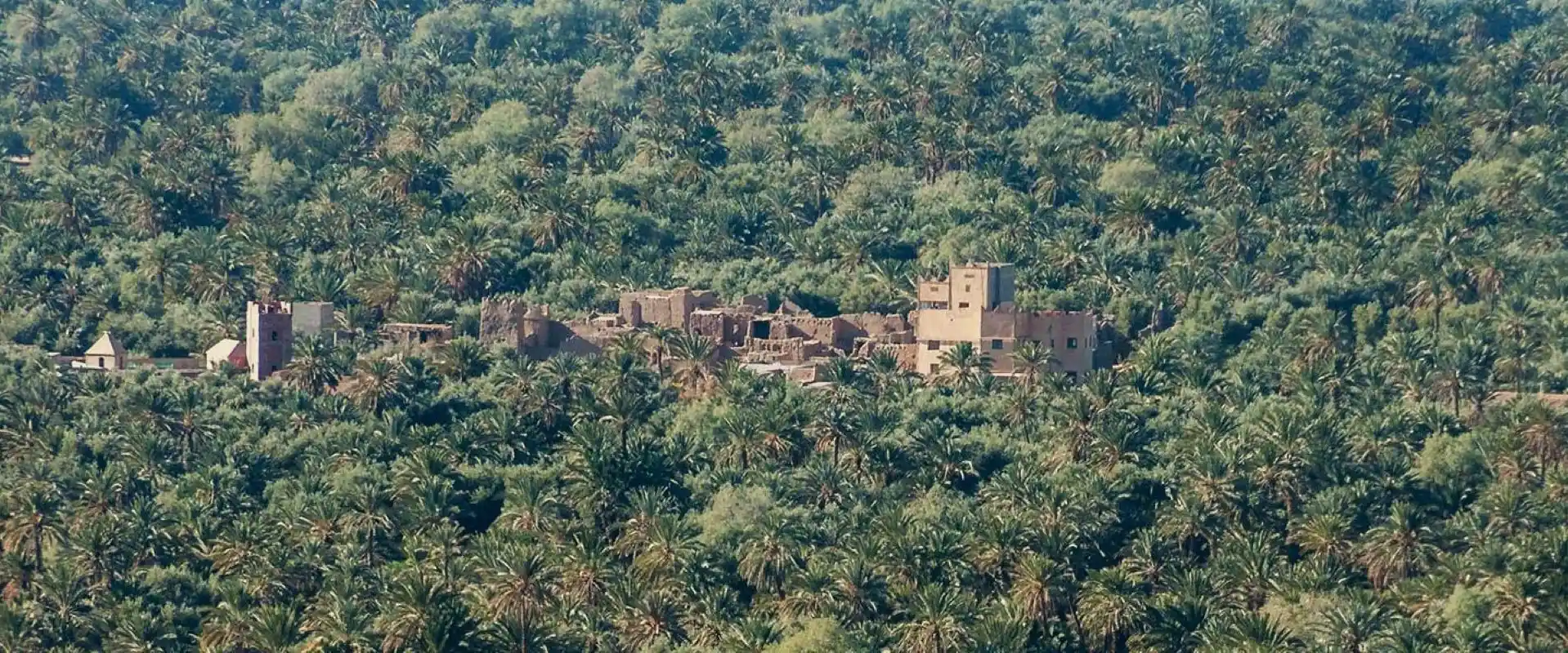
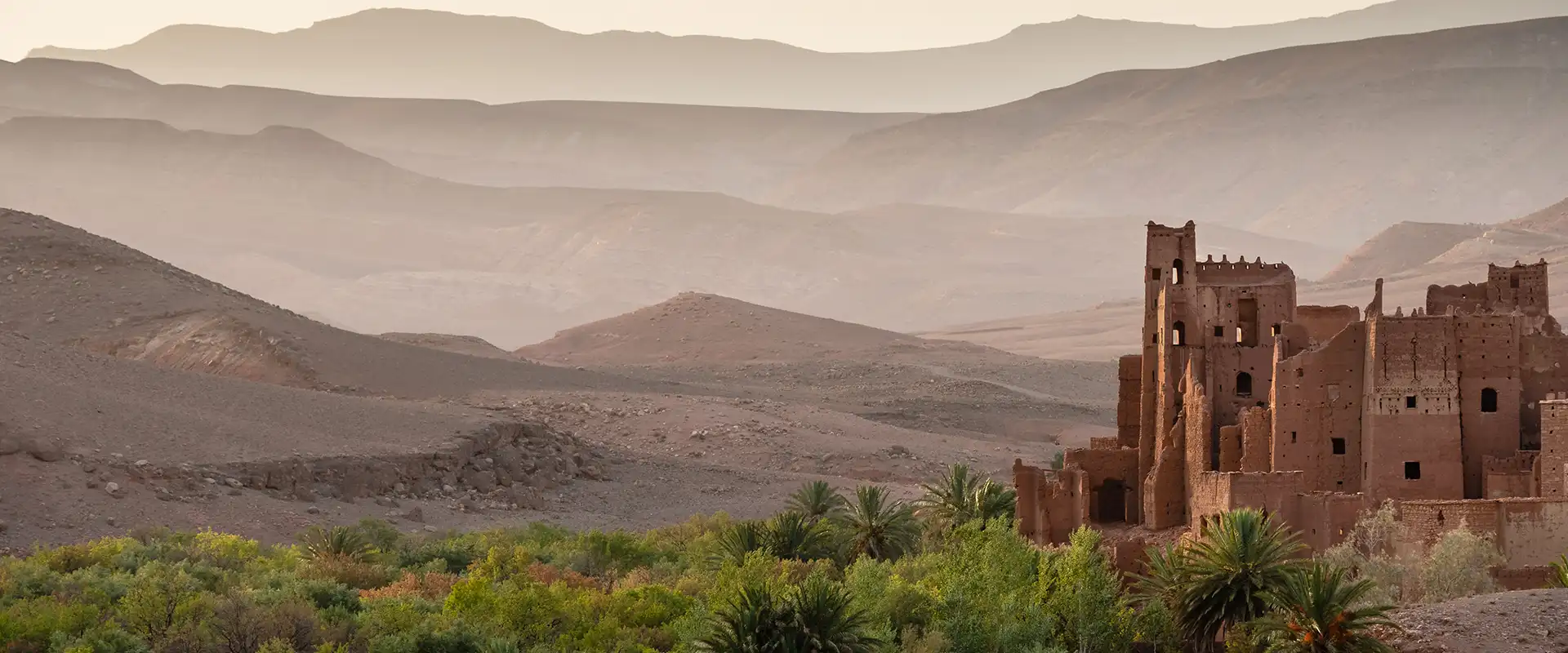
The ksar was not built in a random location. It generally stands close to cultivated land and water while avoiding the occupation of the most valuable farmland. Its houses, clustered together behind walls, form a dense type of settlement suited to an environment in which fertile soil is scarce.
This concentration also facilitated collective life: access to granaries, places of worship and communal spaces, but also the organisation of work and the management of resources.
In the Tafilalet, the development of ksour intensified particularly after the decline of Sijilmâsa. In the Drâa, fortified earthen settlements likewise appeared at the heart of the great medieval irrigated landscapes.
The ksar and the oasis are therefore not two separate forms of heritage: one is the home of a society whose food-producing territory is the other.
This relationship also helps explain why the abandonment of agricultural land can lead to the abandonment of old settlements — and vice versa.
Read more: Kasbah and ksar: the earthen architecture of south-eastern Morocco.
Agriculture organised in several layers
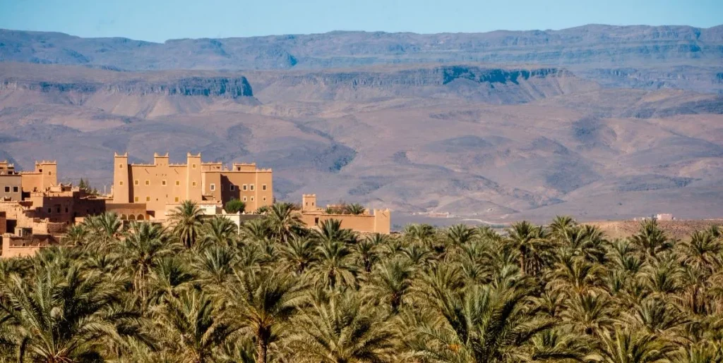
Oasis agriculture depends on the creation of a microclimate.
The date palm traditionally forms the upper layer. Its foliage softens the intensity of the sun and reduces the direct exposure of the crops growing beneath it.
At an intermediate level grow olive, almond, pomegranate, apricot or fig trees, depending on the area.
Closer to the ground are cereals, lucerne, vegetables, fodder crops and aromatic plants.
This layering makes it possible to use the same agricultural space efficiently while reducing exposure to heat. It also creates a diversity far removed from the image of a palm grove consisting solely of date palms.
The exact system nevertheless varies according to altitude, soil and available water. At Skoura, olive and almond trees play a particularly important role. In the Drâa and especially the Tafilalet, the date palm becomes much more dominant.
Read more: Dates of south-eastern Morocco: fruit of the oases and living heritage.
The great oasis landscapes of south-eastern Morocco
There is no single model of an oasis. Landscapes vary according to the width of the valleys, altitude, water availability and the history of each territory.
To understand an oasis on the ground, it is worth looking beyond the palms: identifying the source of the water, following the séguias, observing the organisation of the plots and the position of the ksar in relation to cultivated land. Abandoned areas, old channels and new plantations also tell the story of how these landscapes have changed in recent decades.
Skoura, an oasis on the outskirts of Ouarzazate
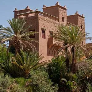
East of Ouarzazate, Skoura offers one of the region’s most characteristic oasis landscapes.
The palm grove combines palms, olive trees, almond trees, gardens and earthen architecture.
Yet its apparent permanence is deceptive. Archaeological and environmental research has shown that the landscape of Skoura has experienced successive phases of cultivation, changes to irrigation networks and, at times, abandonment.
The oasis thus appears not as a fixed system but as a territory continually reshaped according to the water available and the societies that make use of it.
The Drâa Valley, a long oasis ribbon
From Agdz onwards, the Drâa runs through an almost continuous succession of cultivated lands as far as the Saharan fringes.
Traditionally, six major palm groves are distinguished:
Mezguita, Tinzouline, Ternata, Fezouata, Ktaoua and M’Hamid.
They form successive sections of the same great oasis system.
As one travels south, the landscape changes. The valley narrows or widens, palms become increasingly prominent, then cultivated land begins to fragment before gradually disappearing into the desert spaces around M’Hamid.
The Middle Drâa Valley is now one of the principal areas of research into the early history of Saharan oases. Archaeological programmes have revealed hundreds of sites and shown that its agricultural history stretches back well before the great medieval caravan routes.
Tinghir and the Todgha Valley
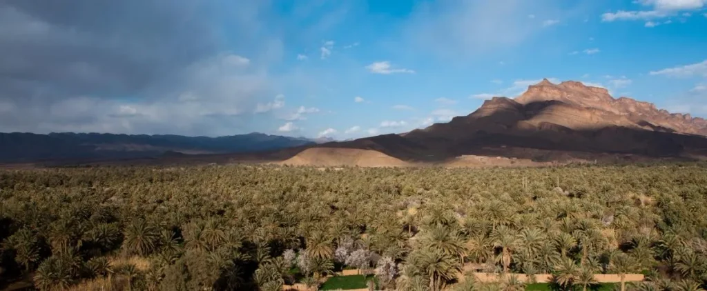
At Tinghir, the palm grove follows the Todgha wadi in a narrow green strip enclosed by particularly arid reliefs.
The contrast is spectacular, but above all it reveals the close dependence between agriculture and the watercourse.
Gardens, villages and ksour succeed one another according to the topography and access to irrigation, while the valley gradually narrows towards the gorges.
The Ghéris, from Tinejdad to Goulmima
Farther east, Tinejdad and Goulmima belong to the Ghéris basin.
Here too, the oasis follows the valleys and their irrigation systems, but the landscapes are more open than those of the Todgha.
Ksour and cultivated plots bear witness to an old pattern of settlement organised around control of water.
The Ziz and Aoufous
Between Errachidia and Erfoud, the Ziz Valley passes through several oasis landscapes.
The palm grove of Aoufous, seen from the heights overlooking the valley, offers one of the most striking views of this landscape: a dense ribbon of crops and palms enclosed between almost bare plateaux.
The contrast explains better than a long description what an oasis is: a concentration of life made possible by water.
The Tafilalet, a vast historic oasis
Around Erfoud and Rissani lies the Tafilalet, regarded as Morocco’s largest natural oasis. Its lands are supplied by the Ziz and Ghéris basins and have been shaped by centuries of hydraulic development.
This is also the territory in which Sijilmâsa developed.
The present-day landscape of ksour, palm groves and canals is therefore the heir to a particularly long history, even though its forms have changed considerably since the medieval period.
Fint, an oasis on a different scale
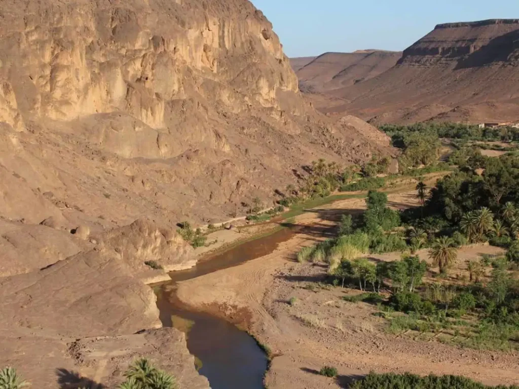
A few kilometres from Ouarzazate, Fint presents a very different landscape.
Smaller and enclosed by dark rocky reliefs, the oasis follows the wadi around several villages and gardens.
On a reduced scale, it makes the very principle of the oasis easy to grasp: a few springs or flows of water are enough to create a strip of vegetation and settlement in an otherwise almost entirely mineral environment.
Discover: Fint Oasis: a secluded valley on the outskirts of Ouarzazate.
Oases under growing pressure
These landscapes are ancient, but they can never be taken for granted.
Their balance depends on there being enough water to irrigate the land while still allowing underground reserves to replenish.
Today, that balance is under pressure from several directions.
Repeated droughts reduce the water coming down from the mountains. Motorised pumping makes it possible to reach deeper groundwater but can accelerate the lowering of the water table. Some soils are affected by salinisation, while other land is abandoned through lack of water or labour.
In the Tafilalet, the decline of many khettaras illustrates this transformation directly. As pumping lowered the water table below the level of the old galleries, they gradually dried out. Modern water-management infrastructure has also profoundly altered irrigation practices since the 1970s.
Yet it would be misleading to tell the contemporary history of the oases as one of uniform and irreversible disappearance.
Some land is abandoned; other plots are brought back into cultivation. New irrigation systems appear. Farmers adapt their crops, while conservation programmes attempt to maintain the older palm groves.
The oasis has always been a landscape transformed by people.
The question today is how far that transformation can continue without breaking the balance that makes the oasis possible.
A living heritage to preserve
In 2000, UNESCO recognised a large part of these territories by creating the Oasis du Sud Marocain Biosphere Reserve.
Today it covers more than 7.18 million hectares, extending from the southern slopes of the Atlas to Saharan areas. UNESCO highlights the role of these systems in combating desertification, their biodiversity and their importance to communities whose livelihoods depend on agriculture.
This recognition does not mean that oases should be frozen in time.
They have lived through centuries of climatic, political, economic and social change. Their heritage lies precisely in this capacity to adapt an arid environment to human life.
The challenge today is to preserve what gives the system its coherence: water, agricultural land, knowledge and skills, architecture, biodiversity and the communities that continue to keep it alive.
For in south-eastern Morocco, the oasis is not simply a remarkable landscape.
It is one of the oldest and most enduring forms of human adaptation to the land.
Read more: The oasis carries the seeds of Morocco’s future — and the world’s.
Key points
- An oasis is not a natural palm grove but a landscape created through the control and sharing of water.
- In the Drâa Valley, oasis agriculture and permanent settlements are attested between the fourth and eighth centuries, before the great medieval expansion.
- Between the ninth and thirteenth centuries, the expansion of the oases accompanied the growth of towns and trans-Saharan trade routes.
- Sijilmâsa, in the Tafilalet, was for several centuries one of the great crossroads between the Maghreb and sub-Saharan Africa.
- Séguias, dams, wells and khettaras reflect different techniques developed to capture and distribute water.
- The ksar, cultivated land and irrigation networks belong to a single territorial system.
- Skoura, the Drâa, Todgha, Ghéris, Ziz and Tafilalet each present different forms of oasis landscape.
- Declining water resources, pumping, drought and social change are now placing some of these systems under pressure.
- The Oasis du Sud Marocain Biosphere Reserve, created by UNESCO in 2000, covers more than seven million hectares.
A question? Something to share?
Use our contact form.
Discover South-East Morocco